Tuesday, August 7, 2007

In-depth Review of the Field Process

While it may seem to some that the majority of our time here at SEEP is spent lounging on the beach, we do actually accomplish significant work. Presently, the group has surveyed a total of 105 "squares" which amount to a total of 10,500 square meters (mathematically, that area would be equal to a 1 km wide path, 10.5 km long). However, this area is still a fraction of the total survey area.

Survey area organization:

The survey area is aligned on a a grid pattern. Each "square" of the grid is 100 meters by 100 meters. These squares are differentiated by a number system. Rows (traveling East-West) are given a Roman Numeral, while Columns (traveling North-South) are given an Arabic Numeral. So, for example, a particular square might be identified as "XXXII-42", meaning that it is in the 32rd row and the 42nd column. See the map below for further detail:


Each of these squares is then divided into 10 "transects". Each of these transects is 10 meters wide, since it is assumed that each individual is capable of seeing 5 meters in every direction. Unfortunately, we do not have 10 people surveying at once; we only have 7. So we are forced to use an interesting zig-zag process in order to complete 4 square segments. This process is shown in the Field Director's notebook:


The group does the best to take advantage of its numbers. We first will travel across 2 squares, covering 7 transects. We then turn back and finish the remaining 3 transects in those squares as well as 4 transects from 2 parallel squares. We then turn back yet again and complete the remaining 6 transects in those squares, along with 1 extra transect to help account for any drift.

The "Field" aspect:

The process is far from an exact science, but we have organized it as much as one can while standing waist high in grape vines and thorns. To begin with, we locate the corner of a square and mark it with flagging tape:


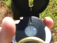
Once the corner has been located and marked, we choose a "leader" for the day. The leader is responsible for keeping the group aligned (either North-South or East-West, depending on which direction we're traveling). This person must always keep a compass handy, continually checking the direction that they are traveling and tracking the distance:


The responsibility does not rest solely on the leader though. Each individual in the group has their own compass and is responsible for noting a natural landmark that corresponds to the direction they are traveling and walk toward it:


The leader will stop after 20 meters (each transect is divided into 20m long sections, recognized as A-E) and realign the group:


On occassion--a very frequent occassion--we will come across some sort of obstruction in our surveying which requires us to travel around or over it. The most common are fences and gulleys (sometimes seperate, sometimes organized next to one another to increase the difficulty in crossing them).


In many cases our battles with fences cause casualties in the ranks as well:


As we travel along, we are responsible for taking notes which describe the area, the objects we
find, and any other interesting information:


Of course, after all of these things, the main goal of the survey is to actually find archaeological objects. This can however be difficult, since the ground coverage in the survey area is often thick and overgrown. Beyond this, many objects are very small. Feel free to try and find the archaeological objects in the photos below. The objects will be circled in pictures at the bottom of the post so that you can tell how accurate you were. Some are easier than others, which is also the case in the field.


After we have completed 4 full squares, we normally take a group break in the shade and rehydrate.


Wednesday, August 1, 2007

It's not your Elementary School "Field day"

Just about everyday is "Field Day" for the members of SEEP. But the three-legged race and softball throw are not on the list of offered events. Instead, SEEP members are allowed to participate in "walking" (an endurance sport created back in the 1960's), "looking" (a more modern addition to the triathlon), "stopping" (a side effect resulting from the creation of "walking" in the 1960's), and "picking things up" (a recently developed sport that requires extreme dedication and training before mastery).

Example of "walking":


Example of "looking":


Example of "stopping":


Example of "picking things up":


As you can see, the SEEP team is made up of an extraordinary band of professional athletes, all of whom can demonstrate these four very different techniques with expert precision. When executed properly and with repetition, the SEEP crew is often successful in identifying a variety of archaeological sites. At present we have identified several prehistoric sites, areas of Roman influence, and just recently we identified a site from the early bronze age which offered up a total of 290 pieces of obsidian (a volcanic glass used for creating blades and other sharp points) and many sherds of pottery (most of which were not collected).
But what exactly makes us professionals?
Well, saying that all we do is "walk, look, stop, and pick things up" is an incredibly simple interpretation of a relatively complex proceedure. To begin with, we can't walk just anywhere. The campos area that we survey is divided on our map into 100 x 100 meter squares. These squares are then divided into ten 100 meter long "transects." Each team member walks in the middle of a transect (it is believed that a person can see clearly 5 meters on each side). These 100 meter long transects are then further divided into 20 meter long sections. As we are walking through each section, we are taking careful notes of the visibility, geographical features, and the objects which we observe. Some of these objects (pottery sherds of higher quality, pieces of obsidian, and remains of man-made structures) are worth further examination. At this point the individual will stop and determine if the object is worth collecting. On occassion, a team member may identify many noteable objects in a specific area. It is then up to the Field Director to decide whether the area deserves a more detailed investigation. If the area yields a high number of objects (enough to signify the area as having a substantial human influence), it will be identified as a "Find Spot." Each of these Find Spots (such as the afore mentioned area in which we found 290 pieces of obsidian) is recorded using GPS and is given an identification number. Once the Field Director feels that we have thoroughly examined the site and collected all the relevant materials, then we continue on with our survey of that area. At the end of the day, each team member is responsible for entering all of their note sheets into the computer catalog and cleaning any objects found that day.
While SEEP doesn't have the pleasure of enjoying a typical Elementary School "Field Day," we instead enjoy a different sort of "day in the field." Our day is--hopefully--marked by numerous discoveries of varying significance. Whether we are pleasantly surprised by a sleeping turtle, shocked by a passing snake, or elated by a significant habitation site, we are always thrilled to be out in the field, quencing our insatiable thirst for discovery.