Sunday, February 19, 2012

Information for 2018 GAP team members-HOW TO GET TO KARYSTOS


Karystos is located on the southern coast of the island of Euboea (pronounced Evia), which means that you need to take a ferryboat to get there. The ferries to Euboea leave from the port of RAFINA (ΡΑΦΗΝΑ), located on the eastern coast of Attica. Rafina is on the opposite coast of Attica in relation to Athens. You can get to Rafina either straight from the airport or from Athens. If you have enough funds, you can use taxis in both cases. The cheapest way to get to Rafina, however, is by bus.
Buses (coach) from Athens
The best place to catch the bus to Rafina is the Ethniki Amina metro stop. You need to get on the Blue Line (No. 3, see the map of Athens metro lines) that connects the center of Athens (for those unfamiliar with Athens, the triangle between Monastiraki, Sintagma, and Omonia is usually considered to be the center-see the map) and the Airport, and travel in the direction of the Airport. Once you get off at the Ethniki Amina stop, you need to use the exit on your right that leads to the Ministry of Transportation (NOT the one that goes to the Ministry of Defense). Once you’ve reached the street level, you need to immediately turn left from the escalators and you will see a pedestrian island with a bus stop on it. Left from the bus stop (which is there for city buses) is a signpost with a simple metal yellow sign saying "KTEL" (KTEΛ) and "Attica Regional Buses." This is where you wait for the bus. Buses to Rafina run on every 30 min or so and their destination is visibly marked in front of the bus. Keep in mind that you need to flag the bus down unless you see other people doing it before you. The ride lasts approximately 1h but this can vary broadly depending on the time of day and traffic. You need to get off at the last stop, which is in the port itself, so you won't be able to miss it. The price of the bus ticket is currently less than 3 Euros.
An alternative place to catch the same bus to Rafina is its starting point in the center of Athens on MAVROMATAION (Μαυρομματαίων) STREET (marked in red on the map to your right). The street is located just a few blocks away from the National Archaeological Museum. The best way to get there is using the trolleys no. 3, 5, 11, or 13. These trolleys all go through the center and you need to get off one stop after the Museum, on the Patission (Πατησίων) Boulevard; Mavromateon is the street parallel to the one trolleys use, slightly up from where you exit, behind the School of Economics. An alternative way of getting there is to take the Green Line (also known as Line 1 or Elektriko) of the metro, in which case you need to get off at Viktoria (ΒΙΚΤΩΡΙΑ) station (see the map) traveling in the direction of Kifissia and walk two blocks up from the exit. Catching the bus there instead of at Ethniki Amina might be a better solution if you are already in Athens and/or have a lot of luggage. There are many KTEL buses leaving from Mavromateon Street and most of them are going to one of Attica's sea ports, so be sure you find the right Rafina bus (it is marked, see above). If you are already in Athens, you can also get a cab to take you to Mavromateon Street. The cabs inside Athens are cheap, but getting one is often a challenge. 
The Google map below might be easier to navigate. It shows Mavromataion, Patision, and the Viktoria Metro stop.
Taxi from Athens
At the Ethniki Amina metro stop there’s a taxi station where you can get a cab to Rafina. Cabs are usually parked between the exit from the metro and the KTEL station, so you can’t miss them. The fare to Rafina is about 13 euros, although that may vary (some cab drivers tend to charge foreigners a bit more).
Buses from the airport
There is a direct bus line connecting Athens airport with Rafina’s port. Buses run on every hour, more or less, depending on the season. Once at the airport you will be able to get directions on how to reach the bus stop, which is attached to the terminal building, behind the buses that go to downtown Athens

This is the link where you can see departure times of KTEL buses from Athens and the Airport to Rafina: http://ktelattikis.gr/en/en_airport_timetable
Taxi from the airport
I wouldn’t recommend those, if you can avoid it. When taking a cab from the airport you are liable to pay extra fees, many of which are obscure. With all the fees included your fare to Rafina or Athens shouldn’t be more than 35-40 euros, but that’s just an estimate.
Boat from Rafina
Once you are in the port of Rafina, which is conveniently the last bus stop, you need to get to one of the numerous ticket agencies. Be careful, you need to get a ticket TO MARMARI and not Karystos. The price is about 8 Euros one way. The ferry ride is approximately 1 hour long.
THE FERRY SCHEDULE 

Bus from Marmari to Karystos
If I or one of the team members is for some reason unable to come pick you up from the port of Marmari, you will need to take the local bus to Karystos. It is a very short ride (c. 15 min) and the bus fare is approximately 2 Euros. The bus to Karystos is parked in the port and you will see it the moment you get off the ferry (there are no other buses there). You need to stay on the bus until the last stop, which is in the center of Karystos, just above the town church. 
Taxi from Marmari to Karystos
If nobody is available to pick you up, you can also get a cab from the port (they are usually parked right next to the place where the ferries dock) and the taxi fare is 10-15 Euros (fixed price, no taximeter). You need to tell the cab driver to take you to the church (Ayios Nikolaos) in Karystos (church = ekklissia) and then somebody will meet you there.


Thursday, November 13, 2008

1st INTERNATIONAL SYMPOSIUM- CALL FOR ABSTRACTS
STYRIA GAIA
The Archaeology of Styra & Southern Euboea
Styra, 3-5 July 2009
Organization: Styra Municipality & University of the Aegean

Styra and Southern Euboea contain a rich history but yet mysterious and unexplored archaeological material. Within the frame of showing up of the cultural heritage and the reinforcement of cultural tourism in Styra and Southern Euboea the Municipality of Styra organizes the 1st International Symposium about Styra and Southern Euboea in 2009. The aim of this symposium is to bring together experts to present new archaeological findings and relevant information from their archaeological studies in the region between Eretria and Karystos related to cultural materials and ways of cultural management and presentation of monuments, artifacts and palaeolithic finds for the benefit of the residents, the regional economy and the visitors. New light will be shed on the unknown history of the region including, settlements and settlers, ancient culture and activities of past human societies, flora and chlora, the natural environment, all interacted in the triptych people- culture- environment. The Symposium’s thematics include: - archaeology since palaeolithic times to Byzantine period - palaeontology – palaeoanthropology - Folklore - ancient environment - archaeometry (the natural sciences in the study of cultural heritage) - museology for the region - ancient history - settlement intercommunication - ancient harbours - settlers and colonists - archaeogeomorphology - Dragon Houses and ancient Quarries - Cave studies.
The Municipality of Styra intents to publish the proceedings as a special issue of the international journal Mediterranean Archaeology & Archaeometry (www.rhodes.aegean.gr/maa_journal).

Accommodation
All participating speakers are covered for accommodation and meals by the Municipality of Styra.

Abstracts
A summary of the proposed oral presentation should be prepared and submitted to liritzis@rhodes.aegean.gr not later than 30th of January 2009

Organising Committee
Sophia Moutsou (Mayor of Styra) Panagiotis Mitropetros, Philologist Akrivi Leka, Envir. Eng. Ass.Prof Yiannis Zervas, Univ. of Athens Dr Nicolas Zacharias, Univ of Peloponesse Gerasimos Artelaris, PhD Cand. Dr George Polymeris, Physicist Secretariat: Municipality of Styra (styra@hol.gr; tel 22240-29280).

Scientific Committee
Ioannis Liritzis, prof at the University of the Aegean- scientific coordinator Dr Ioannis Bassiakos, NCPR Demokritos Prof. Pierre Ducrey, Director Swiss School of Archaeology Dr Sylvian Fachard, Scientific Secretary, Swiss School of Archaeology Dr Rozina Kolonia, Ephor, 11th Dept of Antiquities, Chalkis Prof. Don Keller, Boston University Prof. Eirene Lemos, Oxford University Prof. Nikolaos Moutsopoulos, Aristotle Univ of Thessaloniki Prof.Petros Themelis, Univ. of Crete Prof George Theodorou, Univ of Athens

Tuesday, November 11, 2008

2008 Kampos Survey

Admittedly late, I would like to say a few words on our Kampos related fieldwork in the summer of 2008.

The main part of the Karystian Kampos survey ended with the 2007 season and we have had very important and somewhat unexpected results (see below). Especially significant were our findings of prehistoric remains in parts of the Kampos where we thought they would be covered by alluvium. Moreover, our prehistoric sites almost exclusively consist of lithic (obsidian) scatters, however of the size and magnitude not previously recorded in the area. This has further corroborated the hypothesis that the Karystia was an important part of the prehsitoric obsidian trade/exchange (e.g. Keller et al. (forthcoming) "Prehistory of the Paximadhi Peninsula", Instap Publications). Our work in 2008 was geared towards trying to obtain even more information from the lithics sites.

Our aim was to conduct detailed on-site micro-survey of selected sites to collect the material we might have missed previously. We chose the largest obsidian scatter (findspot 07N35) as our 2008 target. With two intersecting N-S and E-W axes we divided the location into 4 sectors. Each sector was further subdivided into E-W running transects, which were in turn subdivided into 2X2 m squares. The 2X2 m squares served as our basic recording units. Each square was collected in detail by a 2 person team. During the 2-week period we were able to survey most of one of the sectors. As we expected, we collected a lot more material that we missed in 2007 and which consists mainly of microflakes and larger fragments probably uncovered by erosion during the time between the last visit we made to the site in 2007. These types of materials are very important for understanding the exact nature of the site and for statistical analyses.

The team in the field consisted of Rie Larsen, Mia Toftdal, Renate Storli, Davor Cakanic, Svein Hauge, and Zarko Tankosic (field director). This field season was also funded by a grant from the Institute for Aegean Prehistory (INSTAP), for which we are extremely grateful. Last, but by no means the least, I would like to extend special thanks to Ms. Maria Kosma, the archaeologist of the Greek Archaeological Service in charge of southern Euboea, for her understanding, company, and great help in facilitating our research.

Saturday, August 23, 2008

IN MEMORIAM

With deep regret we must inform the friends of SEEP that one of the founders and co-directors of the project Professor Malcolm "Mac" Wallace passed away at his home on Sunday, August 17, 2008, in his 67th year after a prolonged illness. Professor Wallace's contribution to SEEP is immeasurable and he will be sorely missed.

Wednesday, May 14, 2008

Rafina - Marmari Ferry Schedule

From Rafina, until June 16, 2008
Monday: 8:30, 12:15, 14:45, 18:30
Tuesday: 8:30, 11:45, 14:45, 18:30
Wednesday: 8:30, 12:15, 14:45, 18:30
Thursday: 8:30, 11:45, 14:45, 18:30
Friday: 8:30, 11:45, 14:45, 17:30, 19:00, 20:45
Saturday: 8:15, 11:15, 14:45, 16:30, 19:30
Sunday: 8:15, 11:15, 16:50, 18:50, 20:50, 22:15

From Rafina, June 17 - Septemer 07, 2008
Monday: 5:45, 8:30, 10:15, 12:15, 14:45, 17:45, 20:30
Tuesday: 8:30, 11:45, 14:45, 17:45, 20:30
Wednesday: 8:30, 11:45, 15:55, 17:45, 20:30
Thursday: 8:30, 11:45, 14:45, 17:45, 20:30
Friday: 8:30, 12:15, 14:45, 17:00, 18:30, 20:00, 21:30
Saturday: 8:15, :30, 11:15, 13:00, 14:45, 16:30, 18:00, 20:00
Sunday: 08:15, 11:15, 14:50, 16:20, 17:50, 19:20, 20:50, 22:15.

For detailed instruction on how to get to Karystos from Athens please refer to the post (or just follow the link) from May 19, 2007 titled: "Information for 2007 Kampos Survey Volunteers - How to Get to Karystos".

Tuesday, May 13, 2008

MORE FUNDING!

We are happy to report some more good news - INSTAP has decided to fund SEEP's Karystian Kampos survey with another grant for the summer of 2008. The survey is now almost complete and we hope to be able to make our results public soon. The plans for this summer are to revisit a few of the seemingly more important findspots among the ones located in 2006 and 2007 and to begin the study of the collected material. We are also fortunate to have Dr. Athanassios Vionis from the University of Leiden this summer who will be studying the late Roman and Byzantine material from the survey.
Onward!

Thursday, May 8, 2008

EXCAVATION FUNDING

We are very happy to announce that the Stavros Niarchos Foundation has decided to fund the Ayia Triadha Excavation Project (ATEP). For more details, please visit ATEP pages.

Sunday, May 4, 2008

Plans for Summer 2008

In June and July of 2008 SEEP will continue work on the Karystian Kampos Survey Project. This season is dedicated mainly to the study of the collected material and to the initial preparations for publication. Nonetheless, we plan to revisit some of the most important sites located during the past two survey seasons and to conduct detailed collection of the surface material in order to examine its possible differential on-site distribution.

During the month of June, the Ephorate for Paleoanthropology-Speleology of Southern Greece and SEEP will continue the excavations of the prehistoric Ayia Traidha cave, pending the arrival of financial assistance from the relevant institutions. More details about this project will soon be available at the Ay. Triadha Excavation Project (ATEP) web page.

Sunday, January 13, 2008

The Karystian Kampos Survey Project: Results of the Fieldwork from the Seasons of 2006 and 2007

Zarko Tankosic, Indiana University

[The paper presented at the 109th Annual meeting of the Archaeological Institute of America held at Chicago 3-6 January 2008].

As evident from the title, I present the preliminary results of the two years of field survey in the Karystian Kampos (or plain) located west of the modern town of Karystos in the southern portion of the island of Euboea, Greece. I say ‘preliminary’ because we are fresh off the field and the material has not even been cursorily studied by the team of specialists that Southern Euboea Exploration Project (or SEEP) has gathered to investigate and interpret the survey results. Nonetheless, some very tentative conclusions on the nature of use and occupation of this part of southern Euboea can be drawn from the present level of research. [SLIDE] Combined with other work already done in the area or currently under way, I hope that it will be possible to significantly add to our knowledge of antiquities and ancient habitation in this part of Greece. You will forgive me if I am today slightly biased towards the prehistoric section of the survey results since that section is of particular interest to me. [SLIDE]

The area in question is located west of the town of Karystos in the part of southern Euboea referred to as Karystia. [SLIDE] Karystia geographically consists of the horseshoe-shaped Bay of Karystos and two peninsulas bordering it: on the west there’s Paximadhi and on the east is the Bouros-Kastri region, as we call it, although, as far as I am aware this area as a whole does not have a specific or a universal name. Karystia is on the north bordered by the mountain ranges of Koukouvayia, Ochi, and Lykorema. The Kampos Plain is located northwest of the bay and stretches roughly east-west, starting at the head of the bay, where it is the broadest and where Karystos is located, and going towards Marmari on the western Euboean coast. It is the largest agriculturally viable piece of land in the area and is also fairly well watered, especially in the spring. This part of the island, separated from the rest of Euboea by high mountain ranges and from Attica by the southernmost part of the Euboean channel, which is much wider at this point than anywhere else between Euboea and the mainland, is quite different from the rest of the island in climate and vegetation. In fact, Karystia is, I think, best described as part of the Cycladic area rather than Euboea and the mainland of Greece, with which Euboea, being so close to it, is usually lumped together. A salient feature of the Karystia is Mount Ochi, which towers over the bay at the height of 1400masl. Another important feature that characterizes this region is the strong winds that blow here during most of the year, but particularly in midsummer, during the meltemi season. These winds not only influence the weather but also the sailing conditions and the mood of people who live or just happen to be in Karystia during their season.

[SLIDE] In case you were wondering why this chunk of Greece is archaeologically important, here are some reasons for you—aside from the very nice beaches that provide a wonderful incentive for fieldwork, Karystia forms a triangle with two other adjacent regions—the Cyclades and Attica. Material evidence shows that intensive contacts existed among these regions from prehistory. Thus Karystia, a place which by itself straddles the borderline between island and mainland, is ideal for examining some of the components of mainland – insular and inter-insular interaction. Some of the issues to which Karystia can contribute are the initial settling of the Aegean islands, the nature of prehistoric trade in Melian obsidian (especially in the light of results from our Kampos survey, as we shall see soon), prehistoric sea travel and maritime communication and interaction networks, and so on. Finally, southern Euboea, in combination with its adjacent regions is a suitable ground for examining some of the more elusive, but no less interesting, socioeconomic questions about prehistory identities and social structures and boundaries and how were they formed, maintained, and influenced by interaction.

[SLIDE] As you can see, the Kampos is positioned between the parts of Karystia that were previously surveyed by SEEP. Therefore, one of the reasons for undertaking this survey was to fill in the gap in the survey data from the area. The second reason for choosing the Kampos as the setting for our survey is that the Kampos is the largest agriculturally viable and fairly well watered stretch of land not only in southern Euboea but also among the northern Cycladic islands. We assumed that such piece of land would have been an important resource for people in antiquity. Thirdly, we wanted to test the extent and consequences of possible alluviation in the Kampos to archaeological sites in the area. Finally, one of our main goals was to test the reliability of the so-called ‘route-survey’ method employed in the survey of the eastern part of the peninsula.

The survey was carried out using different methodologies in the two seasons in the field. [SLIDE] The first fieldwork season, which lasted four weeks, was more of a pilot project executed with limited assets in order to get a better idea of the presence or absence of ancient remains in the survey area. The surveying team consisted of between two and four people walking in transects determined mainly by natural or man-made features of the terrain. The methodology intentionally corresponded to the ‘route survey’ of the eastern part of the Bay of Karystos. The transects followed paved and unpaved roads, footpaths, gullies, ravines and current or seasonal water flows. Moreover, two long arbitrary transects that coincided with the edges of the survey area were surveyed on the foothills on both the southern and northern edges of the Kampos. The team members were also allowed to depart from the transects and investigate any areas that seemed promising as potential location of findspots. Only a small representative sample of material was collected during this phase of the survey and only from locations that were designated as findspots.

During the second five-week-long season a different method was used. The survey team in the 2007 season consisted of seven to ten people in the field at any one time. [SLIDE] The entire survey area was divided into arbitrary 100X100m squares, which were then surveyed independently or in clusters using the stratified sampling approach. ‘Stratified sampling’ in this particular case means that the squares to be surveyed were not chosen randomly but with respect to specific predetermined rules; in this case the squares were selected in such a way as to include all the geomorphological features present in the survey area (e.g. southern foothills, northern foothills, central flat plain, proximity to the sea, ravines, gullies, water courses, roads, etc.) as well as take into account some of the results of the 2006 season (e.g. locations of discovered findspots or 2006 transects). [SLIDE] The 100X100m squares were further divided in ten 10m wide and 100m long transects, each surveyed by a team member under the assumption that surveyors are able to inspect an area that extends c. 5m on each side of them. Moreover, each transect was further subdivided into five 20m long sections, which served as the basic recording units in the field. Total, albeit unsystematic, collection was carried out on the surface of all the areas designated as findspots, while the thin material scatter in between the findspots was recorded (in case of non-feature material) or recorded and collected (feature sherds, obsidian, etc.). Naturally, sometimes we had to adjust certain aspects of this ideal methodology to accommodate the situation we encountered in the field; however, the discrepancy that that produced was not large and, for our purposes largely negligible.

Approximately 30% of the entire designated survey area was covered using the intensive methodology just described and perhaps another 5% of the area using the extensive methodology. [SLIDE] In the course of the two seasons in the field 36 findspots were discovered—20 in 2006 and the rest in 2007. A findspot was, in this case, very loosely defined as a restricted concentration of material, which is normally denser than the ‘normal’ off-site scatter or, as it is frequently known, ‘background noise’. Of the 36 findspots at least 15 are either purely prehistoric or have a prehistoric component among the material that can be dated to other periods as well. The material from 3 locations is tentatively identified as Classical or Hellenistic, 21 findspots are either Roman or have a Roman component, and the material found on the surface of 5 locations can be identified as belonging to the Byzantine era. There is only one findspots to which we could not assign a preliminary dating. Please, bear in mind that these dates are highly preliminary and many of them have been assigned while the material was still in the field. It is possible and in fact probable that there will be some corrections once the material is studied by specialists.

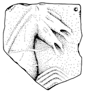
It appears that the off-site scatter of later (e.g. Roman and early Byzantine) material is on average denser in the vicinity of the main modern road that extends roughly east-west and connects Karystos with Marmari. This, in combination with several findspots of the same date located on both sides of the road, suggests that this route could have been used as one of the main east-west thoroughfares in antiquity. Besides this, the post-prehistoric sites of special interest include a [SLIDE] rustic sanctuary of Classical and/or Hellenistic date, [SLIDE] two small Byzantine chapels, one of which is quite well preserved, and [SLIDE] what appears to be a Roman pipe which could still be in situ. Of the findspots we could not date with any certainty the most intriguing is a group of cist-type graves [SLIDE] visible in the scarp created by a seasonal stream. No human or other types of remains were found in the vicinity of the graves so it was not possible for us to date them. This type of constructed cist grave was common in this part of Greece in several periods, starting with the FN. However, the lack of any grave goods combined with the fact that the material found in the vicinity was all of late Roman – early Byzantine date, suggests that the safest assumption, but only an assumption nonetheless, would be that these graves are dated to one of these periods.

The information we collected about prehistoric periods in the Kampos was, to say the least, somewhat unexpected [SLIDE]. First of all, we did not expect to find as many, or – to be honest – any, prehistoric findspots in the Kampos. Basing our expectations on the results from the 2006 season, where only one prehistoric findspot was located in the foothills north of the Kampos, and the fact that only one prehistoric site was known in the area from years of prior surveys nearby (the EBA Ay. Georgios), we thought that most or all of the prehistoric sites or other evidence in the Kampos must have been concealed by alluvium which has been accumulating in the area in post-prehistoric periods. The second unexpected thing was the nature of the prehistoric findspots we were able to locate. Most of the findspots in the Kampos that are dated to the prehistoric period consist almost exclusively of larger or smaller obsidian scatters. We have found pottery on the surface of only several of those findspots and even there the pottery was extremely fragmented and worn to the point where it is not identifiable. Some of the surface lithic scatters are quite large. For example [SLIDE], on findspot 07N35, located just west of the EBA site of Ay. Georgios, more than 2500 pieces of obsidian were collected from an area of about 150 by 100m in extent. [SLIDE] Another 300 pieces come from findspot 07S28. The amount of material from other such findspots in the Kampos is usually more modest, but still, the almost complete lack of pottery is somewhat confusing.

At the moment I am not able to give you the most reliable dating of the obsidian scatters from the Kampos since the material has not been properly studied. Nonetheless, it seems that most of those findspots can be at least tentatively dated to the EBA period or the FN/EBA transition. The material from the Kampos has two main characteristics—it consists almost entirely of obsidian, which is a characteristic of all the Neolithic and Bronze Age assemblages found in the area thus far, and, second, in some locations the almost complete reduction sequence (or chaîne opératoire) is present in the material, some parts of which you can see, I hope, on this slide. Inconclusive as these results may be at present, they are still informative. [SLIDE] First of all, it is evident from the material and its distribution that southern Euboea was an important center in the EBA obsidian trade in the Aegean. It is hard to say if Karystia was a consumption or redistribution center at this moment, but I believe it could have been the latter. Secondly, it seems that the extent of alluviation in the Kampos was much less detrimental to ancient sites than what was previously thought. This gives us hope that our results, although they represent only a sample, are not entirely biased. Furthermore, if we accept at least as a possibility that the alluviation was restricted and that it did not create as big a bias in our data from the Kampos, then Ay. Georgios was, indeed, the only large EBA settlement in the Karystian Plain. If this proves to be correct then it has implications for the sociopolitical relationship between EBA settlements in the region that have yet to be explored since it is feasible that Ay. Georgios was exercising some form of control of an important agricultural resource such as the Kampos.

To summarize [SLIDE], the results of the survey have shown that the Karystian Kampos was exploited or inhabited during the EB period and after that from Classical and Hellenistic times until the present. Material earlier than FN is missing from the part of Kampos we have surveyed, and we didn’t find any evidence that the area was used between the end of the EBA and the Classical period either. This is more or less similar to the situation in the rest of Karystia and, indeed, southern Euboea, where the earliest signs of human presence are dated to the FN. Moreover, there is no material evidence that belongs to the last phase of the EBA, that is EB3, or to the very end of the EB2 period or the so-called ‘Kastri/Lefkandi I phase’ characterized by the appearance of Anatolian-looking pottery. The only location that has yielded MBA material thus far in southern Euboea is Ay. Nikolaos in the village of Miloi, north of Karystos. The Kampos survey provided no new information on the MBA in the area. The LBA is almost completely absent from southern Euboea, which is a mystery too complicated to be addressed here. Although no Iron Age or Geometric material has been identified in the part of the Kampos included in our survey, a relatively large settlement from this period existed on and around the Plakari Hill just southeast of the Kampos at the edge of our survey area. Finally, Roman and particularly late Roman and early Byzantine times are extremely well represented in the material from the Kampos and the rest of Euboea, which is either a sign of increased population or of more intensive use of the plain. Material from those periods is also the one most commonly found off-site.

[SLIDE] Before I finish I would like to thank the wonderful team of volunteers who helped us survey this summer, the Institute for Aegean Prehistory for financially helping our work and the other individuals who either helped us with the field research or who have taken their time to read and comment upon this presentation.

Thank you.

Figure: The Kampos. Red: boundaries of the survey area; Blue: Transects surveyed in 2006; Yellow: Squares surveyed in 2007

Saturday, November 3, 2007

REPORT ON FIELDWOK IN 2007

Under the auspices of the Canadian Institute in Greece (CIG) and with the kind permission granted to us by the 11th Ephorate of Prehistoric and Classical Antiquities at Chalkis (IA EPKA) and its ephor Mrs. R. Kolonia, the Southern Euboea Exploration Project (SEEP) was able to continue work in the area of Karystos in July and August of 2007. The project was partially funded by the Institute for Aegean Prehistory (INSTAP). The primary focus in 2007 was fieldwork consisting of survey in the alluvial plain (Kampos) west of the town of Karystos. This season saw the continuation of the project which SEEP began in 2006 and completes the planned two-season fieldwork component of the project. The work was made possible and greatly facilitated by the help from Ms. Maria Kosma, the epimeletria for the region as well as Mrs. Sofia Stambelou and Mrs. Evangelia Athanasiou, the museum guards at Karystos. Our special thanks go also to Mrs. Maria Chidiroglou of the Hellenic Ministry of Culture for serving as the co-field director of the SEEP Kampos survey.

Work in the field

In July and August of 2007 members of SEEP continued the survey of the Kampos plain west of Karystos. Maria Chidiroglou and Zarko Tankosic served as the co-field directors of the project. Members of the surveying teams were: Chaya Litvack, Hather Kehres, Lina Kokkinou, Kristen Mann, Melissa Lemieux, Mia Toftdal, Rachel Vykukal, Renate Storli, Rie Larsen, Svein Hauge, and Mark Tassone. Ms. Heather Kehres also served as an associate field director and we would like to especially acknowledge her contribution to the project.

The fieldwork was conducted in the course of five weeks in July and August of 2007. The goals of the survey were same as those of 2006: to examine a hitherto archaeologically poorly known part of the Karystia; to methodologically and spatially connect the previously surveyed areas in the region where different survey methods were employed (e.g., the Bouros-Kastri region to the east and Paximadhi peninsula to the south); to test the hypothesis that in an alluvial plain like the Kampos the probability of finding sites increases in the vicinity of modern roads and paths, gullies, and the foothills of the surrounding hills; and to test the hypothesis that some of the modern routes were also used in ancient times.

Methodologically, the season of 2007 was very different from the one in 2006. The entire survey area was divided into arbitrary 100x100m squares, which were then surveyed independently or in clusters using the stratified sampling approach. “Stratified sampling” in this particular case meant that the squares to be surveyed were not chosen randomly, but with respect to specific predetermined rules. In this case the squares were selected so as to include all the geomorphological features present in the survey area (e.g., southern foothills, northern foothills, central flat plain, proximity to the sea, ravines, gullies, water courses, roads). Square selection also took into account information recorded on the findspots and transects of the 2006 field season. The 100x100m squares were further divided in ten 10m wide and 100m long transects, each surveyed by a team member. Moreover, each transect was divided into five 20m long sections, which served as the basic recording units in the field. Although intensive collection of material was carried out on all of the findspots, the thin material scatter along transect and between findspots was recorded, but not generally collected. Non-findspot collections included diagnostic sherds, and lithics. The collected material was washed, preliminarily categorized, and prepared for storage and further study.

The survey area is spread over the following 1:5000 topographic maps: 6541/5, 6541/6, 6541/7, 6541/8. Approximately forty percent of the designated survey area was surveyed using the 100x100 grid system, which is a sample larger than expected and sufficient for further statistical and predictive analysis. A total of 16 findspots were discovered during the 2007 season. The names of the findspots are in the form of a unique code consisting of the year of the survey (07), location in relation to the main modern road (North or South of it), and an independent running number (01 through 99).

Preliminary results

The preliminary results of the 2007 season suggest that the use of the Kampos in antiquity was more intense than previously expected. Of the 16 newly recorded findspots, as many as 11 are either prehistoric or have a prehistoric component in addition to material of later periods. This was a surprise because it was believed that most prehistoric findspots in the Kampos are covered by recent or ancient alluvium. The prehistoric findspots are characterized by almost complete lack of pottery and they consist mainly of lithic scatters (overwhelmingly obsidian). This is another unexpected and somewhat unusual feature which also seems to be typical for prehistoric findspots in the Kampos. It suggests that the area of Karystia played an important role in the prehistoric (mostly likely Final Neolithic and/or Early Bronze Age) obsidian trade and was, if nothing else, an important consumption center. Although the findspots of later date are not as numerous as those with a prehistoric component, a relatively dense scatter of post-prehistoric material was discovered in the area between findspots as “background noise.” This material, which we will begin to process and analyze next year, will provide important information on the use of the Kampos during Classical, Hellenistic, Roman, and post-Roman times. The Kampos area, being the main cultivation plain of the Karystian chora, could not have failed to attract the attention of the ancient peasant or citizen landowner's attention. Old and sporadic new finds, like a cipollino fragment of an ancient mill (trapetum) and a limestone fragment probably of a grave stone, built into a modern sheep shed, serve as indications of continuous use and cultivation of the area from Late Classical to Early Roman times.

Submitted to the 11th Ephorate of Prehistoric and Classical Antiquities by:

Zarko Tankosic and Maria Chidiroglou

Co-Field Directors, SEEP Karystian Kampos Survey Project

Saturday, September 22, 2007

2007 - End of season


Somewhat belatedly we would like to report a very successful completion of the 2007 field season. As reported previously here, this summer SEEP was mostly involved with the survey of the Karystian Kampos (plain). It is our pleasure to say that we had a very successful and productive season. This was made possible by the wonderful team of volunteers who were part of the survey crew this summer. The team members were: Chaya Litvack, Heather Kehres, Lina Kokkinou, Kristen Mann, Melissa Lemieux, Mia Toftdal, Rachel Vykukal, Renate Storli, Rie Larsen, Svein Hauge, and Mark Tassone (see photos below). Heather Kehres also served as an associate field director and we would like to especially acknowledge her contribution to the project. The season of 2008 is intended to be a study season and we are hoping to publish the results of the Kampos Survey as soon as possible. We would like to thank everybody involved in the field part of the survey for their efforts and help.

Tuesday, August 7, 2007

In-depth Review of the Field Process

While it may seem to some that the majority of our time here at SEEP is spent lounging on the beach, we do actually accomplish significant work. Presently, the group has surveyed a total of 105 "squares" which amount to a total of 10,500 square meters (mathematically, that area would be equal to a 1 km wide path, 10.5 km long). However, this area is still a fraction of the total survey area.

Survey area organization:

The survey area is aligned on a a grid pattern. Each "square" of the grid is 100 meters by 100 meters. These squares are differentiated by a number system. Rows (traveling East-West) are given a Roman Numeral, while Columns (traveling North-South) are given an Arabic Numeral. So, for example, a particular square might be identified as "XXXII-42", meaning that it is in the 32rd row and the 42nd column. See the map below for further detail:


Each of these squares is then divided into 10 "transects". Each of these transects is 10 meters wide, since it is assumed that each individual is capable of seeing 5 meters in every direction. Unfortunately, we do not have 10 people surveying at once; we only have 7. So we are forced to use an interesting zig-zag process in order to complete 4 square segments. This process is shown in the Field Director's notebook:


The group does the best to take advantage of its numbers. We first will travel across 2 squares, covering 7 transects. We then turn back and finish the remaining 3 transects in those squares as well as 4 transects from 2 parallel squares. We then turn back yet again and complete the remaining 6 transects in those squares, along with 1 extra transect to help account for any drift.

The "Field" aspect:

The process is far from an exact science, but we have organized it as much as one can while standing waist high in grape vines and thorns. To begin with, we locate the corner of a square and mark it with flagging tape:


Once the corner has been located and marked, we choose a "leader" for the day. The leader is responsible for keeping the group aligned (either North-South or East-West, depending on which direction we're traveling). This person must always keep a compass handy, continually checking the direction that they are traveling and tracking the distance:


The responsibility does not rest solely on the leader though. Each individual in the group has their own compass and is responsible for noting a natural landmark that corresponds to the direction they are traveling and walk toward it:


The leader will stop after 20 meters (each transect is divided into 20m long sections, recognized as A-E) and realign the group:


On occassion--a very frequent occassion--we will come across some sort of obstruction in our surveying which requires us to travel around or over it. The most common are fences and gulleys (sometimes seperate, sometimes organized next to one another to increase the difficulty in crossing them).


In many cases our battles with fences cause casualties in the ranks as well:


As we travel along, we are responsible for taking notes which describe the area, the objects we
find, and any other interesting information:


Of course, after all of these things, the main goal of the survey is to actually find archaeological objects. This can however be difficult, since the ground coverage in the survey area is often thick and overgrown. Beyond this, many objects are very small. Feel free to try and find the archaeological objects in the photos below. The objects will be circled in pictures at the bottom of the post so that you can tell how accurate you were. Some are easier than others, which is also the case in the field.


After we have completed 4 full squares, we normally take a group break in the shade and rehydrate.


Wednesday, August 1, 2007

It's not your Elementary School "Field day"

Just about everyday is "Field Day" for the members of SEEP. But the three-legged race and softball throw are not on the list of offered events. Instead, SEEP members are allowed to participate in "walking" (an endurance sport created back in the 1960's), "looking" (a more modern addition to the triathlon), "stopping" (a side effect resulting from the creation of "walking" in the 1960's), and "picking things up" (a recently developed sport that requires extreme dedication and training before mastery).

Example of "walking":


Example of "looking":


Example of "stopping":


Example of "picking things up":


As you can see, the SEEP team is made up of an extraordinary band of professional athletes, all of whom can demonstrate these four very different techniques with expert precision. When executed properly and with repetition, the SEEP crew is often successful in identifying a variety of archaeological sites. At present we have identified several prehistoric sites, areas of Roman influence, and just recently we identified a site from the early bronze age which offered up a total of 290 pieces of obsidian (a volcanic glass used for creating blades and other sharp points) and many sherds of pottery (most of which were not collected).
But what exactly makes us professionals?
Well, saying that all we do is "walk, look, stop, and pick things up" is an incredibly simple interpretation of a relatively complex proceedure. To begin with, we can't walk just anywhere. The campos area that we survey is divided on our map into 100 x 100 meter squares. These squares are then divided into ten 100 meter long "transects." Each team member walks in the middle of a transect (it is believed that a person can see clearly 5 meters on each side). These 100 meter long transects are then further divided into 20 meter long sections. As we are walking through each section, we are taking careful notes of the visibility, geographical features, and the objects which we observe. Some of these objects (pottery sherds of higher quality, pieces of obsidian, and remains of man-made structures) are worth further examination. At this point the individual will stop and determine if the object is worth collecting. On occassion, a team member may identify many noteable objects in a specific area. It is then up to the Field Director to decide whether the area deserves a more detailed investigation. If the area yields a high number of objects (enough to signify the area as having a substantial human influence), it will be identified as a "Find Spot." Each of these Find Spots (such as the afore mentioned area in which we found 290 pieces of obsidian) is recorded using GPS and is given an identification number. Once the Field Director feels that we have thoroughly examined the site and collected all the relevant materials, then we continue on with our survey of that area. At the end of the day, each team member is responsible for entering all of their note sheets into the computer catalog and cleaning any objects found that day.
While SEEP doesn't have the pleasure of enjoying a typical Elementary School "Field Day," we instead enjoy a different sort of "day in the field." Our day is--hopefully--marked by numerous discoveries of varying significance. Whether we are pleasantly surprised by a sleeping turtle, shocked by a passing snake, or elated by a significant habitation site, we are always thrilled to be out in the field, quencing our insatiable thirst for discovery.

Sunday, July 22, 2007

A Day in the Life

Dawn breaks, and the SEEP team is typically awoken around 6:30 am either by our own accord, or by the blaring raucous of a Grecian male on a motor bike. The latter, at least from my own experience, seems to be the more common. After such a refreshing night's sleep (often interupted by more blaring motor bikes, the continual honking of car horns, and the highly irritating and unnecessary squeel of tires of every design) the group collects itself around the breakfast table. We each take in a little taste of something, either cereal or fruit normally. Following breakfast, we drive out to the chosen survey site for that day. But, considering there are nine of us and only one compact car, we are required to make two trips out to the site.

The work day consists mainly of slow walking. This "walking", however, is by no mean your standard walk in any way. The lush, green pastures of some hidden glade are far from our working enviroment. Instead, we trounce through the Grecian countryside, which--if you've ever been there--you'd know is some of the most inhospitable countryside on the whole of the earth. The vegitation covering the ground either consists of "some" thorns or "all" thorns, with very little deviation from "all" thorns. Indeed, the plantlife in Greece greatly resembles the country's militaristic past. Like any good hoplite spear, these plants are sharp, tall, and quite unforgiving. Here are a few examples:


There are many more thorny options to choose from, aside from those photographed. I personally have seen (and walked through) thorn bushes wider than my bedroom here at the SEEP house. But aside from all the sharp, pointy excitement, some actual fieldwork is undertaken while surveying.

Recently, the group has made two interesting finds in the past week. First, we discovered a series of large stone walls at the top of a hill. And upon exploration of the area, we discovered nearly one hundred assorted pottery sherds. The second significant find was made on Friday when, on another hillside on the opposite side of the campos, a team member noticed a large collection of pottery sherds on the surface. Close assessment of the area identified a site containing more than one hundred and forty prehistoric pottery sherds. Here are some pictures from the first of these two events along with general pictures of us surveying:


After a hard day of surveying, the team returns home around 2 pm. They are greeted by the hard labor of the team member who had the day off; for that team member is responsible for cleaning the house and preparing lunch. Lunch typically consists of Greek Salad, sliced meats and cheeses, fruits, and sometimes pasta.

Following lunch, our only other responsibility is to enter the data from our survey record sheets into the computer database. Otherwise, our time is free to ourselves. In most cases we nap immediately following lunch. This helps us recover from the hard work of the day as well as deal with the incredible heat of the afternoon. Often we will go to the beach after our naps and enjoy a cool swim in the Aegean.

Dinner does not come until around 8:30 or 9 pm. We normally go to dinner as a group and enjoy the many tastes of the Greek pallet. Dinner in Greece can be a time consuming endeavor. It is expected that everyone sit around the table and talk before finally ending the meal. This said, it can often be 11 or 12 o'clock before we finally return from dinner.

After dinner, if we still have the energy to stay awake, we tend to have drinks and relax before heading off to bed. Then the whole ordeal starts anew the next morning. We are again rudely awakened by the roar of motor bikes, the honks of horns, and the squeels of tires.

Wednesday, July 18, 2007

SEEP Summer 2007: The Early Days

As the dust settled on the warm streets of Karystos, the bus doors opened and released upon the small community the first installment of volunteers for the Southern Euboea Exploration Project. These first four volunteers were then joined the following day by three more adventurous spirits; and the group was finally completed on the third day with the arrival of the final two. The valiant nine stand as follows: from the fjords of Norway hail Svein and Renate; from the lush coasts and the dry deserts of the United States come Heather, Rachel, and Mark; from the Shakespearean lands of Denmark arrive Mia and Rie; and finally, the beautiful island of Montreal, Canada offers us Chaya and Melissa. The team is supported by the fine and inspiring leadership of Field Director Zarko and Project Director Don.

The first few days of our expedition were marked by joy and revelry. Pleasures were had by all as we enjoyed the warm sun and sandy beaches of beautiful Karystos. But just as the smells of fresh souvlaki were enveloping our souls with their rich air, the realization became apparent that indeed we all did come here to do "work". However, our first attempt at "work" was quickly betrayed by several errors in our mapping and orientation systems. So unfortunately, the first day of the survey was ended almost as quickly as it began after just a few hours in the field. The second day was far more successful though. With the orientation problems solved, the team was able to undertake its true objective and survey a small section of the Karystian Kampos. This same ideal was upheld on the second day, although this particular survey area yielded far fewer results (but far more gifts of cuts and scratches from the local thorny brush).

All things considered, this summer season of the SEEP appears to have great potential. Expectations are high and motivations are higher. Perhaps a new discovery will be made in the next few days? Who knows? But until then, we will continue to strive in our quest to unravel the hidden secrets of the plains of Karystos.

Saturday, June 23, 2007

AYIA TRIADA EXCAVATION - UPDATE

The Eforia for Speleology at Athens in collaboration with SEEP has conducted excavations at the Ay. Triada cave between June 18-22. The team members were Lina, Fotini, Fanis, Daisuke (aka Mega) and Zarko. Our results, although modest, have superseded our expectations.

The goal of this field season was to preliminarily examine the cave by opening test trenches to determine whether any undisturbed stratigraphy of cultural layers exists in the cave. We were able to open two test trenches and to excavate them to the bedrock. Our expectations were confirmed by finding undisturbed cultural layers in one of the trenches (trench 2) as well as several in situ features. In this respect, the season was a success. The material recovered from the trenches belongs to different chronological periods (some of them attested in southern Euboea) but is mostly prehistoric of which the material from the later Neolithic phases constitutes the bulk of the pottery and lithic finds. Some of this material is the earliest found in Karystia thus far, lending further support to the importance of this cave site for understanding the earliest habitation in this part of Greece.

We will now begin the study of the excavated material and other data and we will hopefully produce preliminary reports early in 2008. We will also begin the preparations for a larger scale excavation of the cave in 2008.

Below you can see some of the photos of the dig and the crew on and off work. If you are interested in contributing to the Ay. Triada Excavation Project (ATEP), please contact us at ztankosic@gmail.com.